
Established by an Act of Congress
Whereas the University of Alaska, because of its unique location and the work it has accomplished in the past, is a logical site for a permanent geophysical research station … there is hereby authorized to be appropriated … $975,000 for the construction and establishment of a geophysical institute.1946
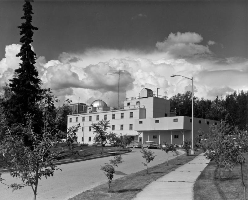
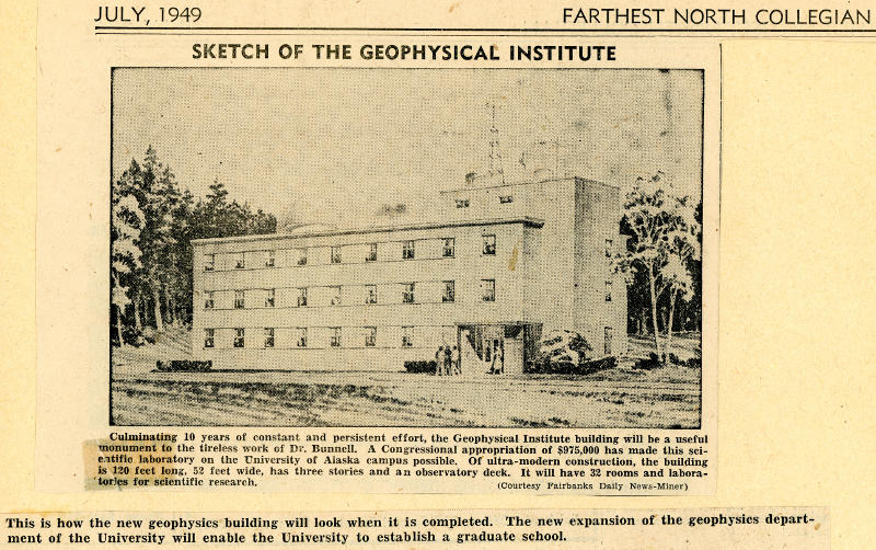
Building Construction Complete
Using $975,000 of federally appropriated funding, construction of the new Geophysical Institute building is complete.
1951Volcanic Activity
Mount Spurr erupts, emitting a plume 10,000 meters above sea level and blanketing Anchorage with 6 millimeters of ash. At the time, there were few instruments to detect and record volcanic activity.

Institute Peak
The Geophysical Institute's Phil Bettler, George Swenson, Keith Hart and Keaton Keller, along with George Schaller, climbed to the summit of a nameless peak in Alaska. The group of climbers named the mountain Institute Peak in honor of the GI. The same year, Alaska's Mount Deborah and Mount Hunter were also scaled for the first time.
1954Sputnik 1 Launch
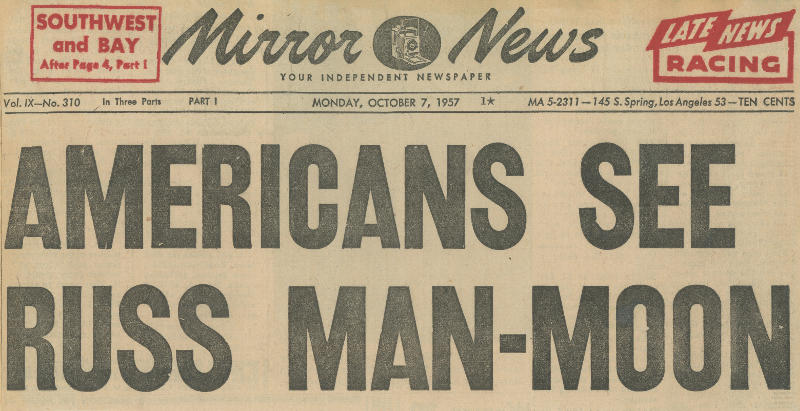
The Soviets launched the world's first artificial Earth satellite. It completed 1440 orbits before burning up while re-entering Earth's atmosphere Jan. 4, 1958.
October 4, 1957Viewing Sputnik 1
Geophysical Institute researchers are the first in North America to view Sputnik 1, the first artificial satellite to be launched into Earth's orbit by the Soviet Union. This same GI team also receives signals from the satellite at Ballaine Lake data receiving facilities.

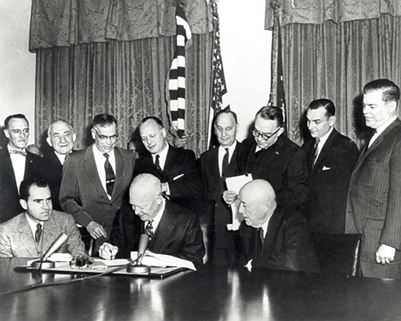
Alaska's Statehood
Alaska statehood is proclaimed on Jan. 3, 1959, after President Dwight D. Eisenhower signs the proclamation making Alaska the 49th state.
Glaciology Studies Expand
Glaciology studies rapidly expand, along with low temperature air pollution, snow cover examination, glacier-volcano interaction studies on Mount Wrangell in Alaska's interior and katabatic wind studies in Antarctica. Carl Benson is instrumental in the development of these research areas.

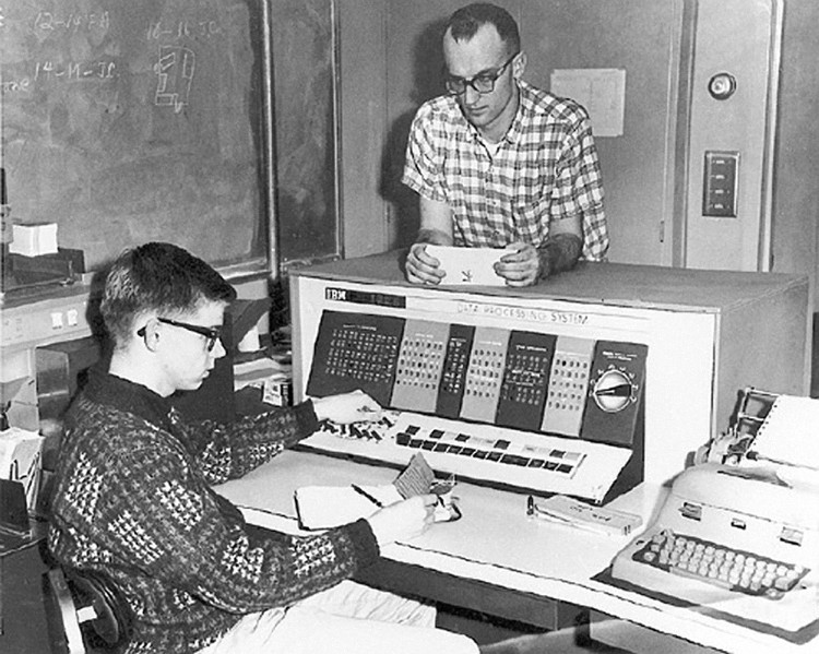
UAF's First Digital Computer
The University of Alaska acquires its first digital computer, an IBM 1620. The computer is used as an aid in basic research, placer valuation, mapping, statistical analysis and data plotting.
Research Expanded
The spectrum of research conducted at the institute is broadened to include glaciology, high-latitude atmospheric studies and solid earth geophysics.
1963
The Great Alaska Earthquake
The Great Alaska Earthquake in Prince William Sound, also known as the Good Friday Earthquake, occurs March 27, resulting in 131 casualties. The quake triggers massive shoreline subsidence, landslides, glacial calving and cataclysmic waves. The Geophysical Institute Seismology Group helps document the impact of the massive event, recording it as a 9.2 magnitude earthquake.
March 27, 1964Syun-Ichi Akasofu Publishes "The Development of the Auroral Substorm"
Syun-Ichi Akasofu, a graduate student under Sydney Chapman, identifies and describes the auroral substorm, an intermittent, one- to three-hour disruption and recovery of normally quiet auroral forms, partly using some observations from the all-sky camera. His findings are published in Planetary and Space Science and have been cited by more than 900 space physicists in their own papers.

Alaska's Oil Industry Begins
Oil is discovered at Prudhoe Bay on Alaska's north coast.
1968
Researchers Launch First Poker Flat rocket
Poker Flat Research Range, the only university-owned and operated rocket range in the world, becomes operational. The first rocket to launch from the range releases barium that helps scientists trace wind and the electric field in the lower ionosphere. Barium released from the rocket creates red streaks that are visible across most of Alaska, simulating the effects of an aurora. Researchers have launched more than 1,000 rockets since then.
1969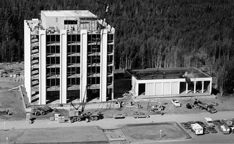
The Geophysical Institute's New Home
Construction of the C.T. Elvey Building, the Geophysical Institute's new home, is complete. Personnel move from the Chapman Building to the new site in June 1970, a project supported by Keith Mather.
1970
Arctic Haze
Geophysical Institute Professor Glenn Shaw discovers Arctic haze, the accumulation and layering of global air pollution in the arctic atmosphere.
1972
Global Warming Signs
Developing climate models of the 1970s provide the earliest indication that the Arctic will be the first region to show the signs of global warming.
1974
8.2 Magnitude Earthquake In China
In July, an 8.2 magnitude earthquake strikes Tangshen, China, killing 242,000 people.
1976
Trans-Alaska Pipeline Complete
The trans-Alaska oil pipeline is complete and operational. Geophysical Institute scientists install equipment to measure possible electrical current induction in the pipeline due to auroral activity.
1977
Aurora Color Television Project for Purchase
The Aurora Color Television Project, a 24-minute-long video recording of aurora footage set to Alaskan composer Gordon Wright's "Symphony in Ursa Major," becomes available for public purchase. Geophysical Institute researchers Neal Brown, Tom Hallinan and Dan Osborne collected the footage from the Poker Flat Research Range using supersensitive television camera equipment.
1985
Chernobyl Nuclear Power Plant
The disaster at the Chernobyl Nuclear Power Plant in Ukraine on April 26 kills, displaces and sickens countless people. Concern heightens over the long-range transport of global pollution toward the Arctic.
April 26, 1986
Alaska Earthquake Information Center Established
The Alaska Earthquake Information Center is established as a collaborative effort between the state of Alaska, the Geophysical Institute and the USGS. The group begins monitoring earthquake activity in Alaska to provide public and government agencies with real-time information on seismic events.
1986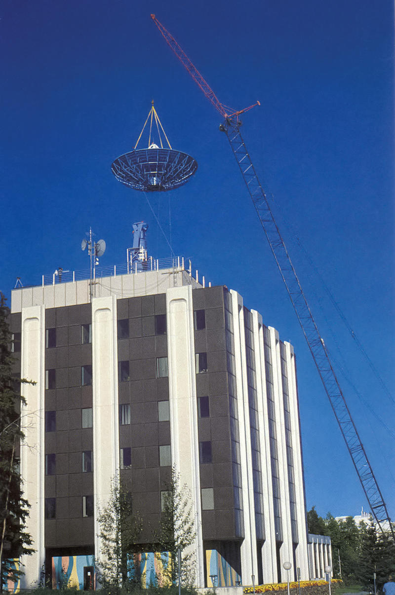
Radar Antenna on Elvey
A synthetic aperture radar antenna is installed on the Elvey Building roof. The 10-meter-wide antenna sits atop a 27-foot pedestal. The addition is funded by NASA as part of a $20 million contract between the agency and the Alaska SAR Facility.
1987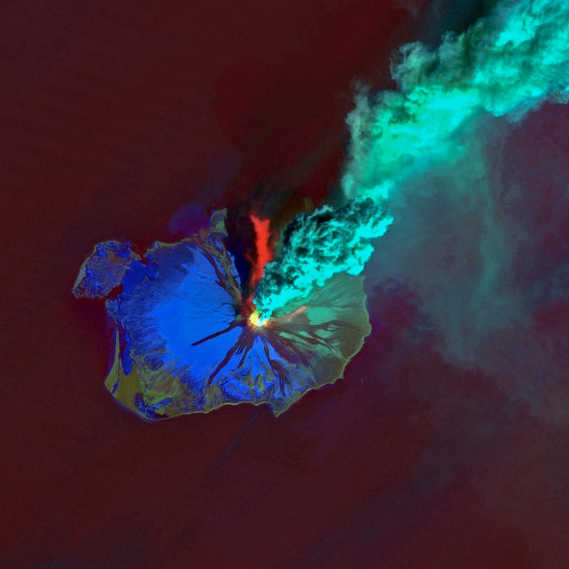
Alaska Volcano Observatory Established
The Alaska Volcano Observatory is established as a joint endeavor between the USGS, the Geophysical Institute and the State of Alaska Division of Geological and Geophysical Surveys. Federal, state and university resources are pooled to monitor and study Alaska volcanoes. The development of prediction methods and recording techniques are a focus of Fairbanks and Anchorage-based researchers.
1988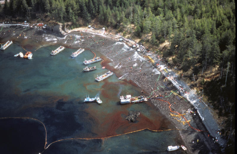
Exxon Valdez Oil Spill
On March 24, the oil tanker Exxon Valdez runs aground on Bligh Reef and spills almost 11 million gallons of Prudhoe Bay crude oil into Prince William Sound. To date, this is the largest single spill in U.S. coastal waters. The Alaska SAR Facility is able to use satellite data to track the oil spill.
March 24, 1989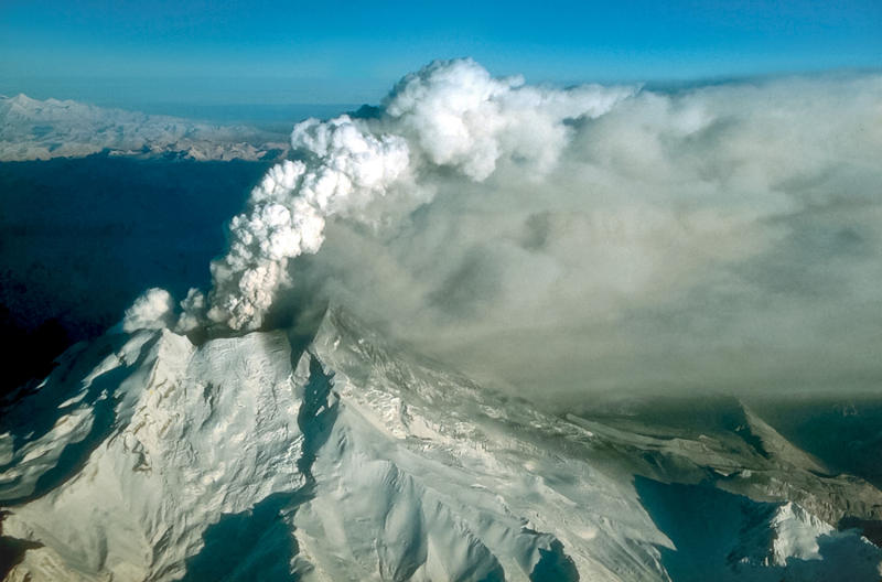
Engine Failure from Volcanic Ash
On Dec. 15, 1989, a Boeing-747 flying from Amsterdam with 231 passengers and 13 crewmen on board enters an ash cloud from Alaska's erupting Redoubt Volcano. All four of the plane's engines die and it takes eight minutes for pilots to restart them. The plane lands in Anchorage; there are no injuries. The plane incurs more than $80 million in damage.
December 15, 1989Remote Sensing Satellite Transmission
European Remote Sensing Satellite, ERS-1, launches on July 17. The Alaska SAR Facility, now the Alaska Satellite Facility, receives its first data transmission from ERS-1 less than a month later.
1991D-Region Phenomena
Red sprites, flashes of light in the ionosphere above thunderstorms, are captured on video and determined to be a D-region phenomena. In July 1993, Davis Sentman and Eugene Westcott photograph intense Midwestern thunderstorms from a specially equipped high-altitude jet aircraft. They capture 19 images of sprites on video.
July 1993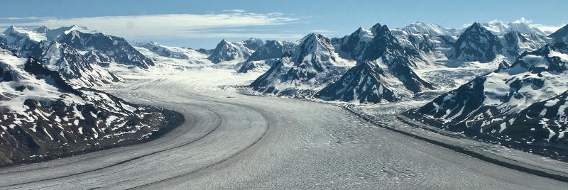
Measuring Glaciers
Geophysical Institute glaciologists Keith Echelmeyer, Will Harrison and Chris Larsen team up with Geophysical Institute Machine and Electronics Shop staff to develop a device that is able to measure the height of glaciers to within 0.3 meters.
1993Rocket Launch from Poker Flat
The 250th major sounding rocket launches from Poker Flat Research Range.
January 30, 1994
All-Sky Camera in Eagle, Alaska
An all-sky camera inside a new automated observing station in Eagle, Alaska, captures all visible auroras within an 870-mile field-of-view of the remote station for six months. The resulting video footage comprises the most complete continuous long-term data set of the aurora ever made.
1995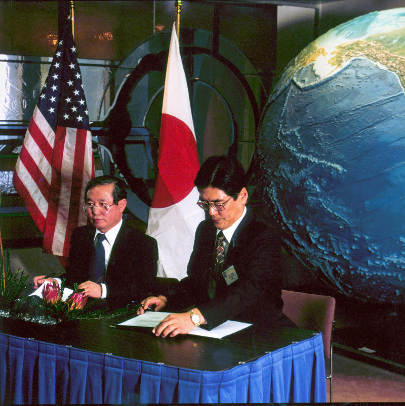
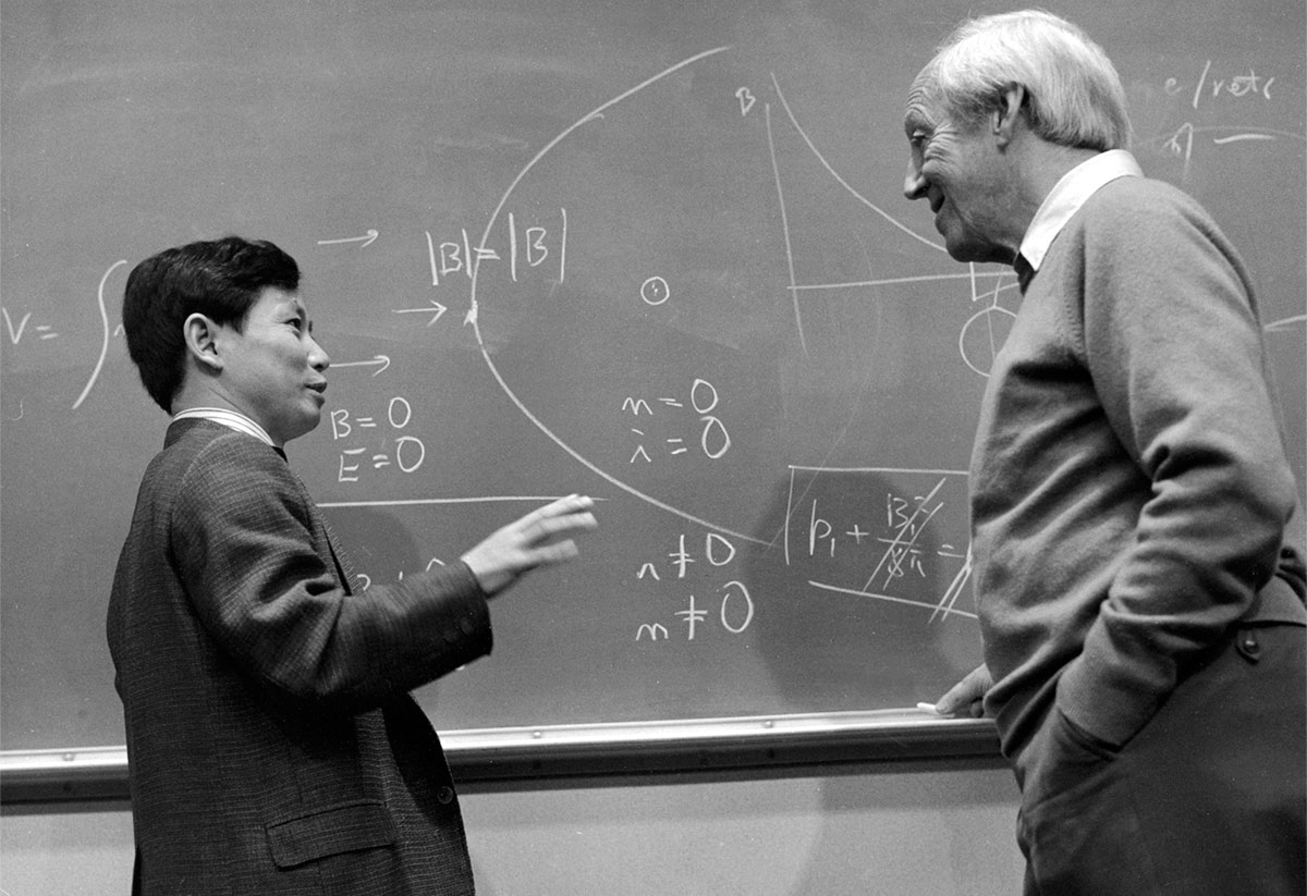
International Arctic Research Center Established
The U.S. and Japanese governments, with the state of Alaska, jointly agree to establish the International Arctic Research Center on the University of Alaska Fairbanks campus as a project of the Common Agenda, which is signed by President Clinton and Prime Minister Hashimoto in March 1997. Syun-Ichi Akasofu is the first director.
1997
Infrasound Array Funded by U.S. Department of Energy
In the summer of 1999 the Geophysical Institute is funded by the U.S. Department of Energy to install a four-sensor infrasonic array in Fairbanks to test its operation under arctic conditions.
1999
7.9 Denali Fault Earthquake
Geophysical Institute seismologists work on the magnitude 7.9 Denali Fault earthquake. The quake shook the state for more than two minutes and scarred 300 kilometers of Alaska's surface. The quake was the largest recorded worldwide in 2002.
November 3, 2002
Open Water Absorbs 300 Percent More Solar Energy
Ice loss in the Arctic Ocean breaks all previous records. Scientists predict the Arctic Ocean absorbed 300 percent more solar energy than it did in 1980, fueling a positive feedback loop of ice melt from warmer ocean temperatures.
2007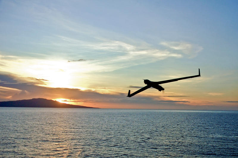
Navy Funds UAF to Study Unmanned Aircraft
The United States Navy awards the University of Alaska Fairbanks up to $47 million to test and evaluate payloads aboard small, unmanned aircraft. The UA Unmanned Aircraft Program, part of the UAF Geophysical Institute, will lead the research. The program will test unmanned aircraft and how they perform in harsh conditions. In addition, they will evaluate payloads, which are packages of data-collection instruments carried on the aircraft. The GI purchased its first unmanned aircraft in 2006.
2010
Deepwater Horizon Oil Rig
The Deepwater Horizon oil rig off the Louisiana coast explodes in April 2010, killing 11. The tragedy results in a devastating spill of more than 200 million gallons of oil. The incident is a sobering reminder of how important a prompt response and clean up is after an oil spill. The UAF Arctic Oil Spill Project is launched in response.
April 2010