New Alaska satellite image map released
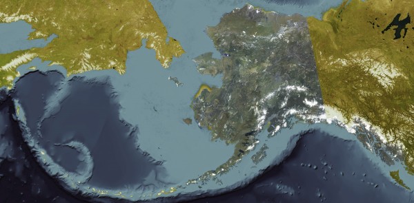
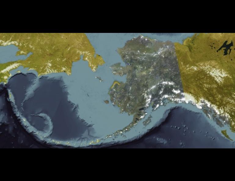
A University of Alaska Fairbanks partnership with the Alaska Department of Natural Resources has made the first high-resolution satellite image map of Alaska.
The map project, called the Statewide Digital Mapping Initiative, provides the most accurate portrait of Alaska’s rivers, roads, mountains and communities.
“The level of detail is so accurate that trails never before identified are represented on the map,” said Tom Heinrichs, director of the Geographical Information Network of Alaska (GINA) at the UAF Geophysical Institute. “The map’s details will guide a lot of decisions.”
UAF and DNR led the Statewide Digital Mapping Initiative. Five other state agencies, the federal Coastal Impact Assessment Program and various contractors participated. The project cost about $5 million over five years.
The map can be viewed in natural color, gray scale or infrared. Online viewers may zoom in and out for detail. The map will also be available in other forms for people, businesses or agencies to adapt to their needs. It is available online at https://www.geonorthis.com/AGCServices.
The new imagery is being used to update topographic maps of Alaska that are decades behind Lower 48 maps in detail and accuracy, said Anne Johnson, DNR’s geographic information officer.
“The Earth is always changing,” she said. The new map will help policymakers make more informed decisions on fire and natural resource management, land use and emergency preparedness, she said. It will help private users make better hunting and fishing trip plans, too.
The map is better than any other satellite-based Alaska map because the data used to build it is about six times better than previously available information, improving resolution and global placement.
The team used satellite imagery collected between 2009 and 2013 to build the map. The team plans to update the map in three to five years, pending funding, said Heinrichs.
ON THE WEB: https://www.geonorthis.com/AGCServices
Sue Mitchell, University of Alaska Fairbanks Geophysical Institute, 907-474-5823, sue.mitchell@alaska.edu
Tom Heinrichs, University of Alaska Fairbanks Geophysical Institute, 907-474-6897, tom.heinrichs@alaska.edu
Anne Johnson, Alaska Department of Natural Resources, 907-269-0880, anne.johnson@alaska.gov
Elizabeth Bluemink, Alaska Department of Natural Resources, 907-269-8434, elizabeth.bluemink@alaska.edu

