Eskers: The Upside-Down Riverbeds
Question: How many times have you seen a riverbed that lies above the level of the surrounding terrain? Answer: If you live in Alaska, probably more often than you're aware of.
Most people who live in areas that have been glaciated are familiar with the jumbled piles of boulders and mixed debris that glaciers have left behind as they retreated. Many know that these features are called moraines. North of the Alaska Range between Black Rapids and Donnelly Dome, and on the southern flanks of the range between Paxson and Sourdough, are two areas where the motorist is forcibly made aware of moraines as the Richardson Highway dips and swerves around them.
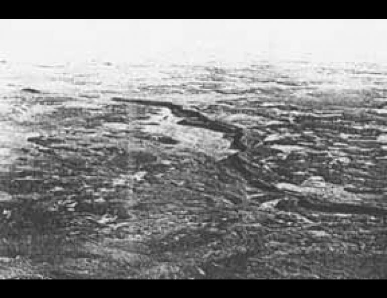
Less common, and sometimes not recognized as being glacial features, are the low, sinuous hills that can stretch for miles and often resemble snakes when seen from the air. These are eskers.
An esker is an ancient river bed that has been formed inside a glacier. As meltwater seeks to escape from the lower levels in the glacier, it forms channels along zones of weakness and eventually emerges from under the ice at the glacial margins. In its passage, the water transports silt and rocks and lays them down along its narrow course. The water is unable to escape laterally because of the confining walls of ice, and the stream bed is gradually built up above the level of the ground on which the glacier rests.
Although they may not be easily recognizable as such from ground level, eskers can be seen from the Denali Highway in the area of Tangle Lakes south of the Alaska Range.