The threat within an Alaska mountain
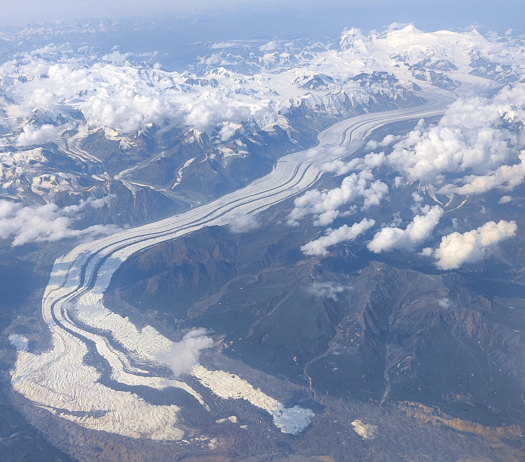
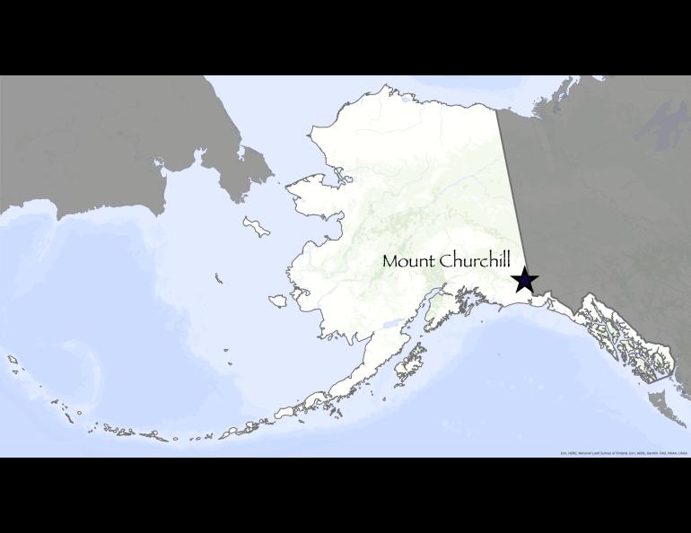
Mount Churchill stands in a white corner of the Alaska map, deceptive in its cold, windblown silence. At least twice in the last few thousand years, the peak’s ice-covered caldera has spewed ash that reached as far as Ireland and piled up to force northern animals out of the territory.
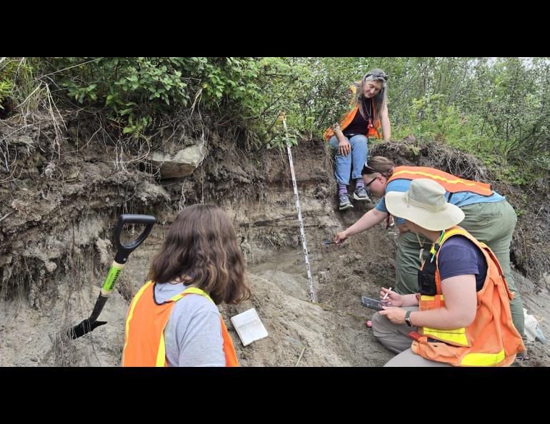
The Alaska Highway and other northern roads are striped with layers of “White River ash” spewed from the volcanic field near Mount Churchill. UAF anthropologists dated ash from a northern lobe to about the year A.D. 420. Another massive plume that winds carried to the east was from an eruption in about the year A.D. 846.
A similar eruption today would bring much of the Northern Hemisphere to a standstill — grounding planes and burying parts of Alaska and Canada with inches or feet of ash.
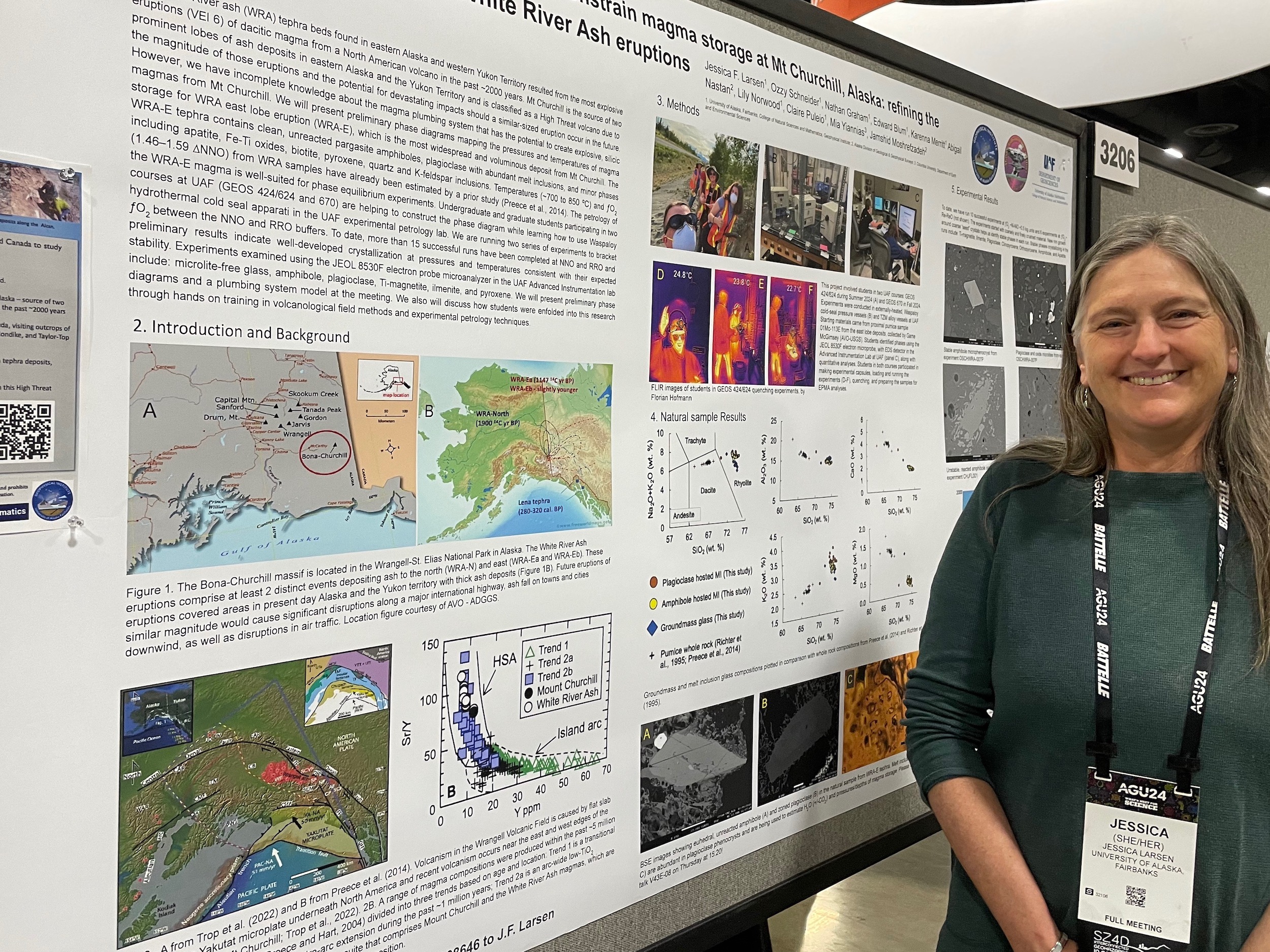
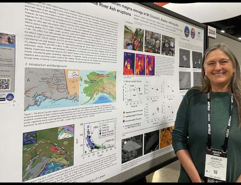
“It’s the most explosive eruption in North America in the last 2,000 years,” Jessica Larsen said.
Few instruments to help predict such an eruption exist in the area.
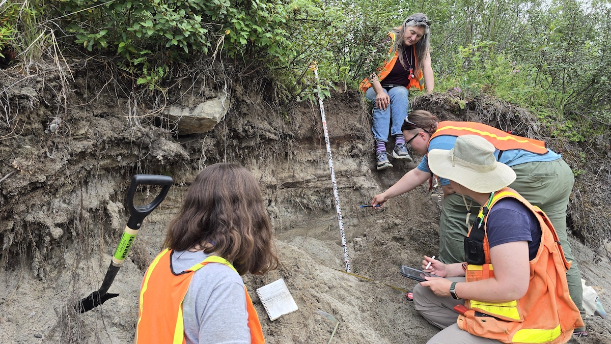
For this reason, during the past few summers, Larsen, a University of Alaska Fairbanks professor of volcanology, has guided students on field trips to sites in Alaska and the Yukon Territory. She and her students look for clues that might help them estimate when another Churchill super eruption might happen.
Researchers from Edmonton, Alberta, postulated that ashfall from the most recent eruption disrupted the migration paths of caribou and salmon. That might have pushed ancient people of the Yukon and Northwest territories as far as the southwestern United States.
An eruption like that today — twice as large as the one that created Alaska’s Valley of 10,000 Smokes — would ground flights on the great circle route that most commercial pilots fly from the Lower 48 to Asia. Chaos would reign wherever ash blanketed the ground.
“These were really huge, explosive eruptions,” Larsen said.
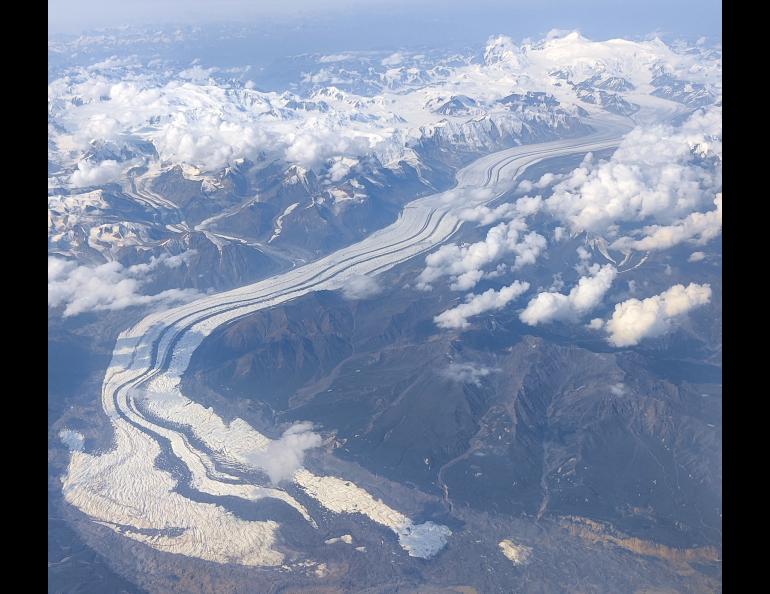
Mounts Churchill and nearby Bona, and the rest of the immense Wrangell Volcanic Field, are hard to reach — there is nowhere on an Alaska or Canada highway where a person can see the peaks. No seismic stations are nearby.
Internal shaking and mountain inflation or deflation are clues scientists use to forecast possible eruptions. Another method — and Larsen’s specialty — is to gather ash from an eruption and work backward. She looks at ash’s fine detail to see how and when magma formed and erupted.
During her 16-day July field trips with college students, Larsen lectures for a few days on the nature of Alaska and the Wrangell Volcanic Field eruptions. Group members then climb into a few vans for a road trip on the paved and gravel highways of eastern Alaska and the western Yukon.
There, the students gather ash that remains like a white ribbon in road cuts and other exposures. After a week of camping in Alaska and the Yukon, class members return to Fairbanks.
In the lab at UAF, students then learn how to heat their ash samples under extreme pressure and quench the hot liquid to create crystals that mimic the magma that reached the surface so long ago.
“We want to find out what the pressure and temperature the magma was at before the eruption,” Larsen said. “We want to come up with a plumbing-system model of the volcano to find out where the magma storage reservoir might be in Churchill.”
If Larsen and others can find where a massive pool of magma lurks, earthquakes within the same area might indicate another eruption is about to happen within the 15,600-foot peak near the Alaska-Yukon border.
As part of the annual Science for Alaska talk series, Larsen will present “An Explosive History: Alaska's Mount Churchill Volcano” on Tuesday, February 25, at 7 p.m. in UAF’s Schaible Auditorium and virtually on Zoom or Facebook Live. More information at gi.alaska.edu.